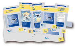
Vous connaissez la légende selon laquelle il y aurait des cartes officielles obligatoires. Ces fameuses cartes, éditées par l’IGN et l’IGN (pourquoi deux IGN?) une fois par an, ou le SIA deux fois par an, ne sont pas réglementaires si elles ne sont pas à jour.
 Ces cartes papiers ne sont pas interdites, mais comme l’information aéronautique change à chaque cycle Airac, soit tous les 28 jours, et même plus souvent avec les Notams, si vous ne tenez pas à jour votre carte papier à la main, même si c’est l’édition la plus récente, elle n’est pas réglementaire. Notez dans l’AMC reproduit ci-dessous la référence explicite au cycle Airac. Une carte papier non tenue à jour est donc hors la loi.
J’utilise une tablette avec logiciel adapté pour avoir l’information à jour du dernier cycle Airac et des notams. Mais j’ai aussi une carte SIA (par définition rarement à jour) en référence. J’utilise aussi la Cartabossy qui est bien pratique.
Ce sera la même chose avec la Part NCO, règlementation qui sera applicable au plus tard en août de cette année (sauf changement):
NCO.GEN.135 Documents, manuals and information to be carried
(…)
(10) current and suitable aeronautical charts
current veut dire à jour, et c’est d’ailleurs précisé dans l’AMC1 NCO.GEN.1 35(a)(10) Documents, manuals and information to be carried
CURRENT AND SUITABLE AERONAUTICAL CHARTS
(a) The aeronautical charts carried should contain data appropriate to the applicable air traffic regulations, rules of the air, flight altitudes, area/route and nature of the operation. Due consideration should be given to carriage of textual and graphic representations of:
(1) aeronautical data, including, as appropriate for the nature of the operation:
(i) airspace structure;
(ii) significant points, navigation aids (navaids) and air traffic services (ATS) routes;
(iii) navigation and communication frequencies;
(iv) prohibited, restricted and danger areas; and
(v) sites of other relevant activities that may hazard the flight; and
(2) topographical data, including terrain and obstacle data.
(b)A combination of different charts and textual data may be used to provide adequate and current data.
(c)The aeronautical data should be appropriate for the current aeronautical information regulation and control (AIRAC) cycle.
(d) The topographical data should be reasonably recent, having regard to the nature of the planned operation

